
Flying North into Alaska’s Wild Heart

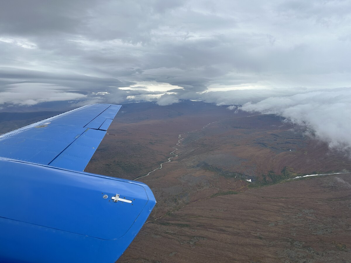
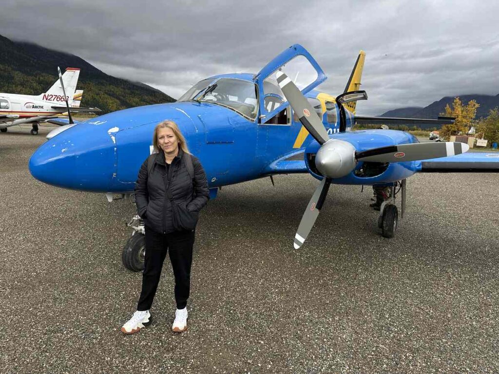
The day began with a breathtaking flight from Fairbanks with the Northern Alaskan Tour Company, tracing the path of the Dalton Highway and the Trans-Alaska Pipeline from above. From the air, the vast wilderness stretched endlessly—miles of spruce forest, braided rivers, and tundra. Cutting through it all were two human-made lines: a narrow dirt road and the steel ribbon of the pipeline. It’s a humbling sight, a juxtaposition of raw wilderness and human determination.
When we landed in Coldfoot, it felt like arriving at the edge of the world. With fewer than 50 year-round residents, it’s more outpost than town. Its name comes from prospectors in the early 1900s who made it halfway to the gold fields, then got “cold feet” and turned back. Today, Coldfoot serves as a truck stop, visitor hub, and testament to the grit it takes to live in Alaska’s Arctic.
Life on the Dalton Highway
From Coldfoot, we joined a ground tour along the Dalton Highway. Here, reality sets in quickly: gas costs $7.49 a gallon (when you can find it), hospitals are hundreds of miles away, and semi-trucks roar past on a narrow, two-lane dirt road. The people who choose to live here lead minimalist lives, pared down to essentials, finding balance with both isolation and the extremes of nature.
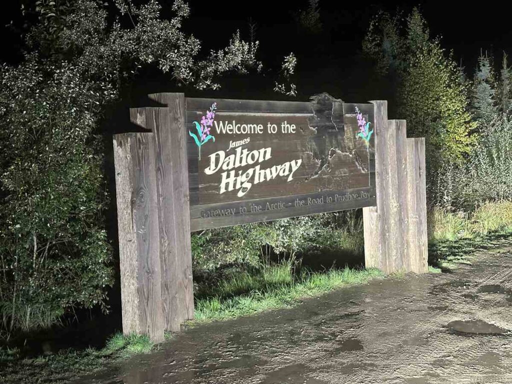
Trivia to Take Home: The Dalton Highway—nicknamed the “Haul Road”—was built to support pipeline construction and remains one of the most remote roads in the United States. Spanning 414 miles from Livengood to Deadhorse, it has only three towns along its entire route and gained fame as the backdrop for the TV series Ice Road Truckers.
Building the Pipeline

Our guide shared a documentary on the making of the pipeline—a project completed in 1977 that stretches 800 miles from Prudhoe Bay to Valdez. Building it was met with fierce opposition, and environmental groups like the Wilderness Society pushed hard for best practices to protect caribou migrations, rivers, and the delicate tundra. Their efforts helped shape a project that, while controversial, incorporated safeguards still relevant today.
It was a quiet accomplishment when I finally stood at the Arctic Circle sign, but one that carried a weight beyond geography. Crossing this latitude made me reflect on the men and women who carved possibility out of impossibility here. The Trans-Alaska Pipeline System (TAPS) is more than an engineering marvel—it’s a story of endurance.
Workers braved temperatures as low as -60°F, months of darkness, and permafrost that fought every construction plan. Camps were remote, accidents were common, and many endured long stretches away from their families. Alongside the pipeline, the Dalton Highway was built as its supply road—still one of the roughest, most dangerous roads in America. Standing there, I couldn’t help but feel that the quiet sense of accomplishment belonged not only to me, but also to the countless workers who gave years of their lives to build it.
Trivia to Take Home: At its peak, more than 70,000 people worked on the Trans-Alaska Pipeline System. Despite the Arctic’s unforgiving conditions, it was completed in just over three years—making it one of the largest privately funded construction projects in U.S. history.
The Yukon River
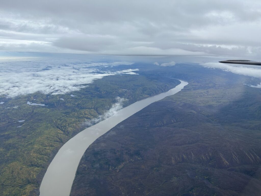
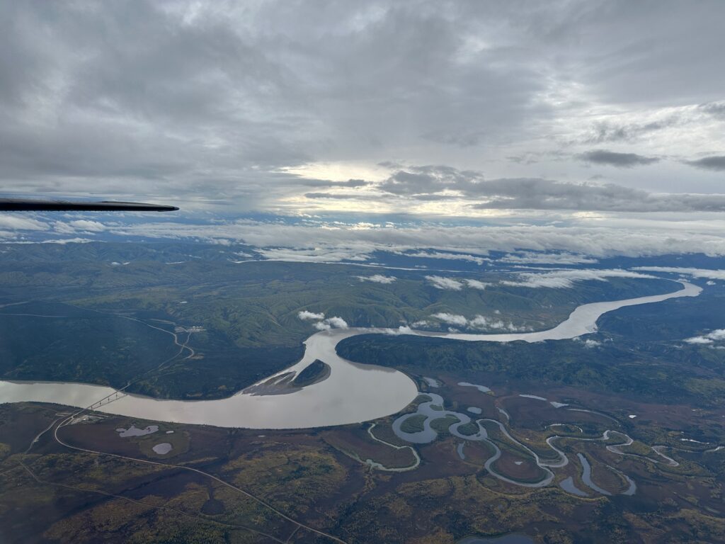
One of the most memorable stops on the fly/drive was the Yukon River, one of North America’s great waterways. Stretching nearly 2,000 miles from British Columbia through the Yukon Territory and Alaska before emptying into the Bering Sea, it has long been a lifeline for people of the North. Indigenous communities have lived along its banks for thousands of years, relying on its salmon runs and its role as a transportation route.
During the Klondike Gold Rush, the Yukon became legendary—thousands of stampeders floated its waters in search of fortune. Standing on its banks, I could almost picture their journey, battered rafts piled high with supplies, dreams as heavy as the river was wide. Today, the river still feels both timeless and immense, its silty waters carrying stories of endurance and survival.
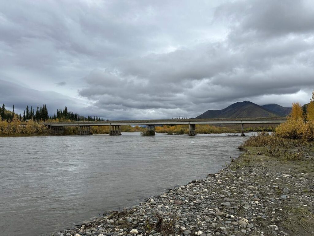
Crossing the Yukon River Bridge on the Dalton Highway was another reminder of how rare infrastructure is in this part of the world. Built in 1975, it remains the only bridge that spans the river in Alaska, connecting the Interior to the Arctic. Driving across its wooden deck, with the pipeline running alongside beneath, was humbling—a blend of natural power and human persistence.
Trivia to Take Home: The Yukon River Bridge is one of the few wooden-decked bridges on the Dalton Highway. Beneath it runs not only the river, but also the Trans-Alaska Pipeline—two lifelines side by side, one natural and one man-made.
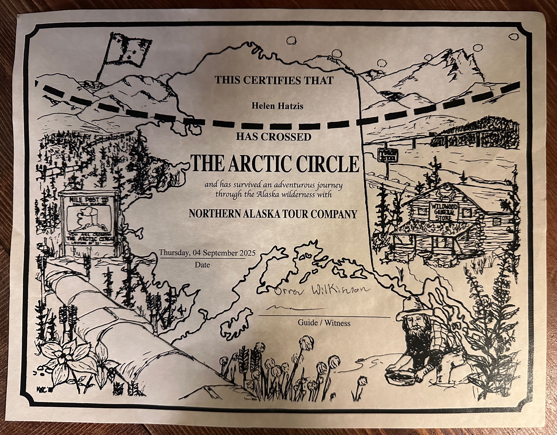
Crossing the Arctic Circle
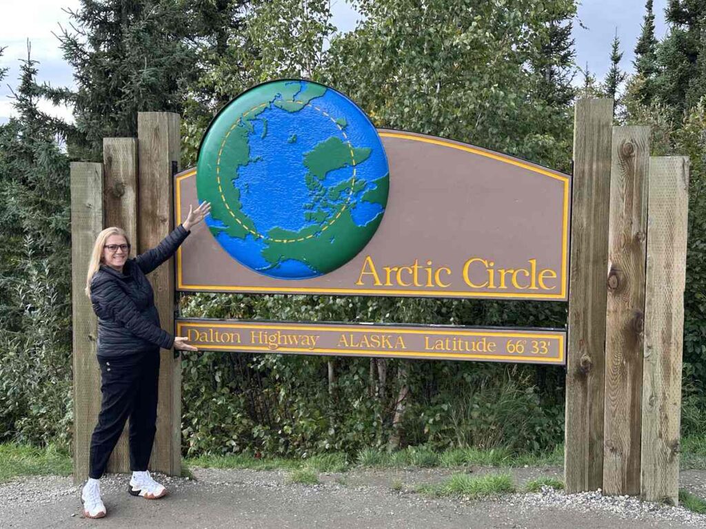
And then came the moment. Crossing the Arctic Circle, marked by a simple roadside sign, wasn’t about fanfare or spectacle. It was personal. Quiet. A reminder that sometimes the most profound journeys are those that humble you—whether by the endless expanse of wilderness, the resilience of the people who call it home, or the immense hardships faced by those who shaped Alaska’s infrastructure decades ago.
It wasn’t just about latitude. It was about understanding what it takes to live, work, and thrive in the far north.
A Road That Tests You
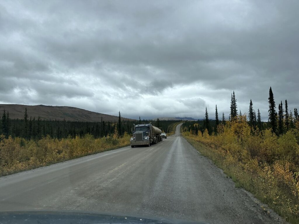
The return drive was a journey in itself. The road south is profoundly bumpy, with the guide swerving constantly to avoid massive potholes—sometimes for hours at a time. It’s a test of endurance as much as scenery. If you’re prone to motion sickness, this may not be the adventure for you.
The Takeaway
This journey north of Fairbanks wasn’t just about reaching the Arctic Circle. It was about perspective—flying over untouched wilderness, landing in a tiny community with a name born of hesitation, driving a road that tests every traveler, and reflecting on the human endurance behind the pipeline and highway.
Fairbanks had already shown me culture, craft, and community. Today, Alaska reminded me of its extremes—the scale of its landscapes, the fragility of its environment, and the strength of the people who live and work here. Crossing the Arctic Circle was both an adventure and an awakening, and it will stay with me long after I’ve left.
Photo Credits: All photos by the author.
Every journey leaves a mark, and small choices can make a big difference. Choosing eco-friendly stays, supporting local communities, and being mindful of plastic use help preserve the beauty of the places we visit. Respecting wildlife, conserving resources, and travelling sustainably ensure future generations can experience the same wonders. Alaska, like many destinations, is striving to do its part—progress is being made, though the path is ongoing. By treading lightly and embracing responsible travel, we create meaningful connections and lasting memories. Here’s to adventures that inspire and footprints that honour our planet. Safe and mindful travels!
Read more on Fairbanks, Alaska: