

Most people driving Highway 101 through Oregon’s central coast slow down, glance at the ocean, and keep going. Yachats is exactly where they should stop.
Known as the “Gem of the Oregon Coast,” Yachats (pronounced YAH-hots) truly stands out as one of the most picturesque coastal towns to visit in Oregon. It earns that title the honest way – not through marketing, but through miles of volcanic rock, an unusually wild shoreline, and the kind of quiet that coastal towns twice its size can no longer offer.
A Town Small Enough to Know Its Own Name
Yachats has fewer than 700 permanent residents, leaving ample space for visitors to enjoy the natural sights and wonders. That smallness is part of its charm. There are no chain restaurants lining the main street, no carnival-style souvenir shops. What you do find are local galleries, a handful of genuinely good seafood spots, and the kind of slow pace that coastal travel was always supposed to offer.
Yachats is a small coastal town located in Lincoln County, about three hours driving from Portland. That distance keeps the overnight crowds manageable, especially on weekdays. Arrive on a Tuesday in October and you may have the basalt ledges to yourself entirely.
The Rocky Shore That Makes Yachats Unforgettable
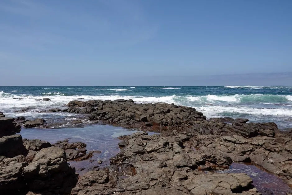
Just about anywhere you can reach the coast in Yachats, you can find tide pools. The rocky shore here is made of Yachats basalt formed from long-ago volcanic eruptions. Today, this rock makes the perfect habitat for intertidal life.
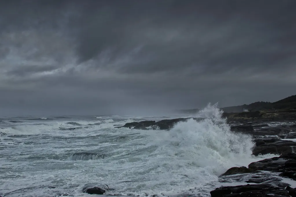
The question here should really be “Where in Yachats can you NOT find tide pools?” The town is all rocky ledges, where the ocean often pounds violently. There are about two or three miles of rocky ledges to explore in town, and you can’t wander these basalt slabs for very long without finding something to peek into.
Tide Pool Life That Surprises Even Experienced Explorers
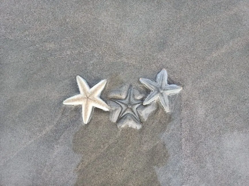
The surrounding area is extra special thanks to Cape Perpetua, a shield volcano that erupted millions of years ago, creating the iconic rocky coastline seen today. The marine reserve is loaded with an array of marine life, from sea stars and anemones to nudibranch and feather duster worms.
The pools here are deep and flush with fresh seawater, making them prime real estate for larger species. Look for the orange and purple Pisaster sea stars clinging to the vertical rock faces. At Smelt Sands State Recreation Site, you can find sea stars, thatched barnacles and gooseneck barnacles, hermit crabs, and both aggregating and giant green anemones.
Oregon’s marine gardens are protected, and removing creatures or shells is illegal. That protection has preserved the quality of these pools for decades, and it shows. The density of life visible at a single low tide here is remarkable.
Cape Perpetua: The Dramatic Headland Next Door
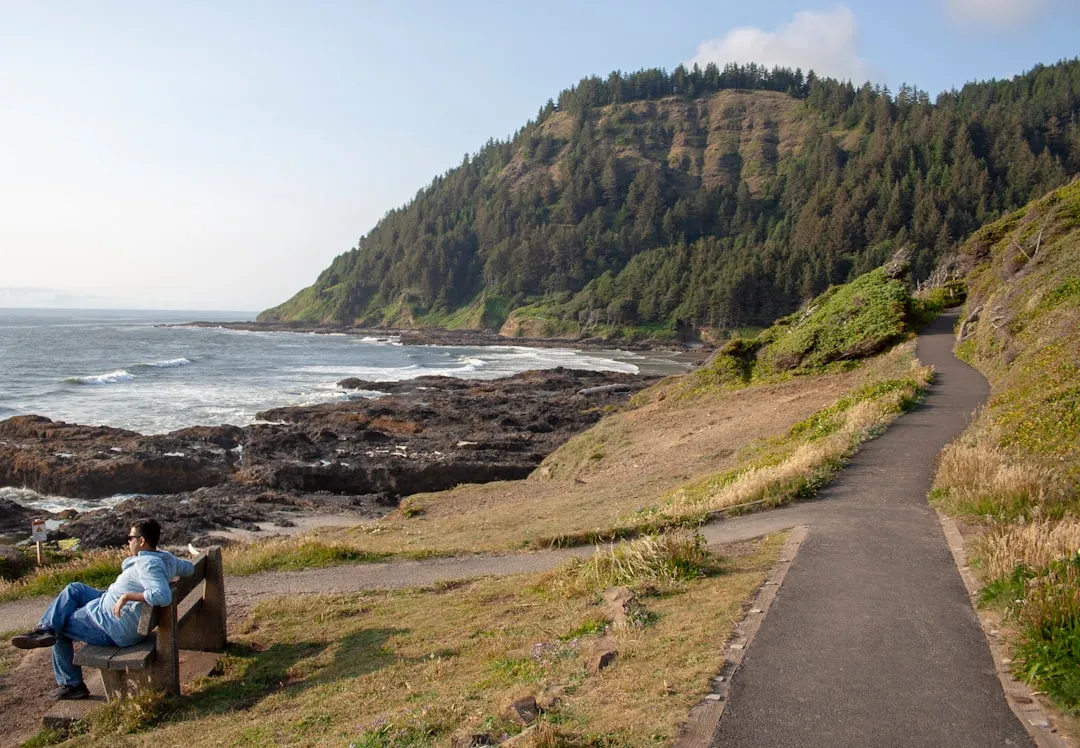
Cape Perpetua is located about two miles south of Yachats, Oregon, along U.S. Route 101. It is a typical Pacific Northwest headland, forming a high steep bluff above the ocean. At its highest point, Cape Perpetua rises to over 800 feet above sea level.
From its crest, an observer can see 70 miles of Oregon coastline and as far as 37 miles out to sea on a clear day. The rocks at Cape Perpetua have a history that began over 30 million years ago with a volcano erupting offshore. This volcano deposited thick layers of basaltic lava that, along with millions of years of erosion and uplift, created the headland and marine platform at Cape Perpetua.
Thor’s Well, Devil’s Churn, and the Power of Moving Water
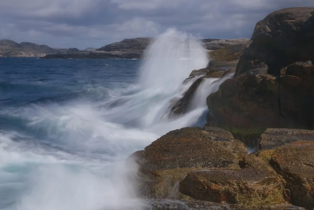
Thor’s Well is a gaping hole on the edge of the Pacific Ocean which appears to swallow the ocean and powerfully shoots it back out over the surrounding rocks. Over thousands of years, a cave grew, the roof thinned, and eventually the top collapsed; the bottom also opened to the ocean, leaving the bowl-shaped formation with openings at both ends.
Devil’s Churn exposes the shoreline’s volcanic history and shows the relentless, violent power of the ocean. The chasm likely started as a narrow fracture or collapsed lava tube in the volcanic bedrock. Over many thousands of years under the constant pounding force of ocean waves, it’s now more than 80 feet wide where it opens at the ocean.
Both Thor’s Well and Spouting Horn are best seen approximately an hour before high tide to an hour after high tide. Timing your visit around the tide makes the difference between a visual curiosity and something genuinely breathtaking.
The 804 Trail: Yachats’ Most Beloved Walk
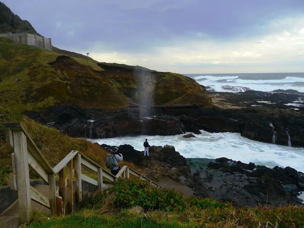
Yachats’ 804 Trail is one tumultuous surf moment after another, as a paved trail meanders past jagged, black basalt rock ledges and finger-like structures that create areas where the sea gets compressed. It’s accessible, short enough for most fitness levels, and remarkably varied in what it shows you.
The name derives from the distance between Yachats and Waldport, supposedly 8.04 miles. Starting out along Ocean View Drive toward the ocean, it travels north through the Yachats and the Smelt Sands State Parks and ends at some seasonal stairs that descend to a seven-mile stretch of sandy beach. Along the way are expansive ocean vistas and access to tide pools.
Just past Smelt Sands, you’ll find the famed spouting horn: one of those striking, wowing discoveries along the Oregon coast where sea water gets compressed so much it fires into the air in a dramatic whoosh, sometimes 30 feet high or more.
The Annual Smelt Run: A Coastal Phenomenon Worth Planning Around
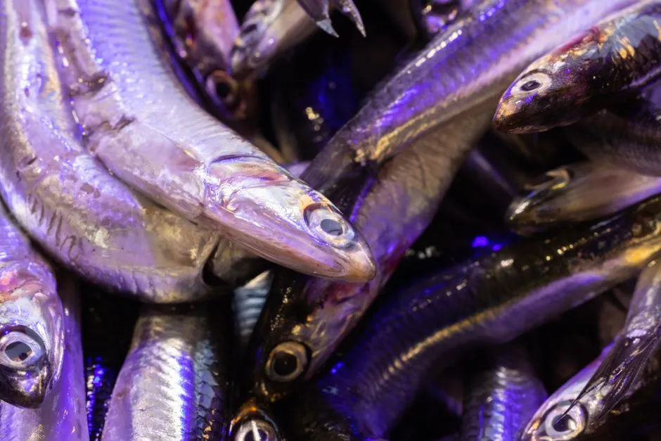
Smelt Sands State Recreation Site is known for tidepooling, rock fishing, and the yearly smelt run – smelt are small, silvery relatives of salmon. Spring brings the smelt run, when small fish swarm the shore in massive numbers, creating a wildly unique natural event worth planning a trip around.
These sands form the perfect place for smelt to lay their eggs. It was about 100 years ago this place was teeming with them, with major numbers of fishermen along the shore here, until they netted the waters dry of the smelt. Before that, for thousands of years, native tribes used this as a fishing ground.
Indigenous History and Cultural Depth
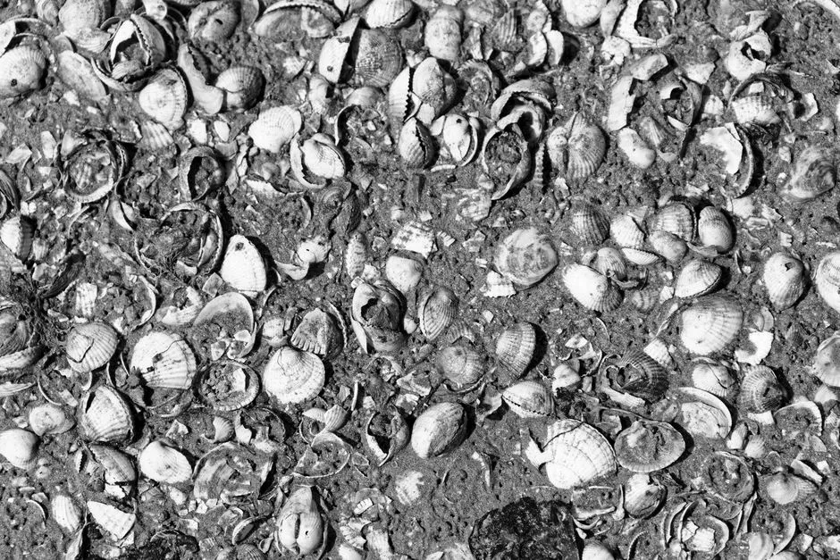
For at least 6,000 years, Native Americans hunted for mussels, crabs, sea urchins, and clams along the coast near Cape Perpetua. Cape Perpetua was part of the southern territory of the Alsea people. In their language, the Cape was named Halqaik, which might mean something like “exposed place.”
Yachats was the location of the Alsea Sub-Agency internment camp, where members of the Coos, Coquilles, Lower Umpqua, Alsea, Siuslaw, and other coastal tribes were forced to march on Oregon’s trail of tears, resulting in many deaths and terrible suffering. Today, Amanda’s Trail is named in honor of a blind Coos woman with a particularly sad story. Visiting with that history in mind brings a dimension to the landscape that tourist brochures rarely mention.
Along the Captain Cook Trail, you might notice the ancient shell midden – a visible layer of discarded shells left by the Alsea people over thousands of years. It’s one of those details that stops you mid-step. The coast here has been a source of life and sustenance for a very long time.
Guided Tide Pool Programs and Citizen Science
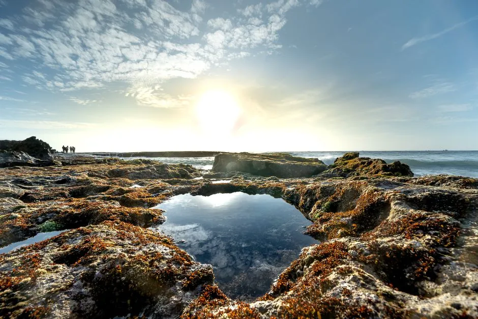
The Cape Perpetua Collaborative, a nonprofit group named after the scenic headland about two miles south of Yachats, offers a variety of immersive programs along Oregon’s craggy Central Coast for nature lovers and citizen scientists. Sign up for a tour with the Tidepool Ambassador Program in summer during a low tide, and guides will take you to vibrant tide pools teeming with sea lemon nudibranchs, purple sea stars and maybe even an octopus.
The Marine Reserve Ambassador Program unfolds on weekend mornings at nearby Smelt Sands State Recreation Site, where visitors can connect with volunteers for tips on how to view creatures properly. For those with a passion for science, the collaborative also hosts “BioBlitzes” that allow participants to document local biodiversity using the iNaturalist app for research.
What to Expect When You Visit Yachats
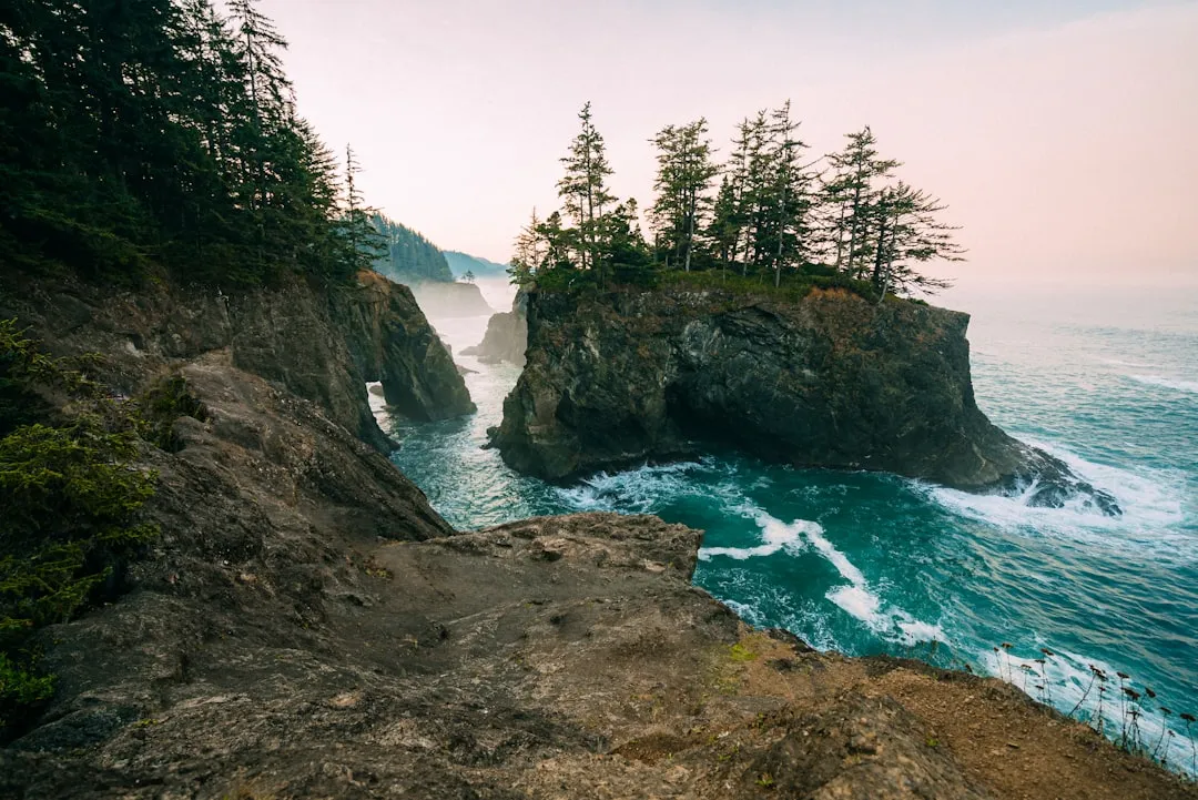
The weather in Yachats is generally cool and damp with frequent rain throughout the year, with the exception of July and August. Temperatures rarely get too hot in summer, with highs in the 60s to 70s Fahrenheit. Spring and autumn are a mix of sunny and rainy days. Pack layers regardless of the season. The coast operates on its own terms.
Yachats is a small town with a tight cluster of cafes, brewpubs, and seafood restaurants on Highway 101. Luna Sea Fish House is known for fish and chips and ocean views. Yachats Brewing and Farmstore serves local beer and farm-to-table food. Green Salmon Coffee Company is the standard pre-tide-chart morning stop.
The best time to visit tide pools on the Oregon coast is two hours before low tide. Visiting tide pools two hours before the low tide will give you plenty of time to explore the area and leave before the water rises again and covers them up. Download a tide chart app before you arrive, and plan your first morning around that window. Everything else can wait.
Yachats asks very little of you and gives back an extraordinary amount. The basalt is ancient, the marine life is unhurried, and the town itself has no interest in performing for a crowd. That, more than anything, is what makes it worth the drive.
AI Disclaimer: This article was created with the assistance of AI tools and reviewed by a human editor.