
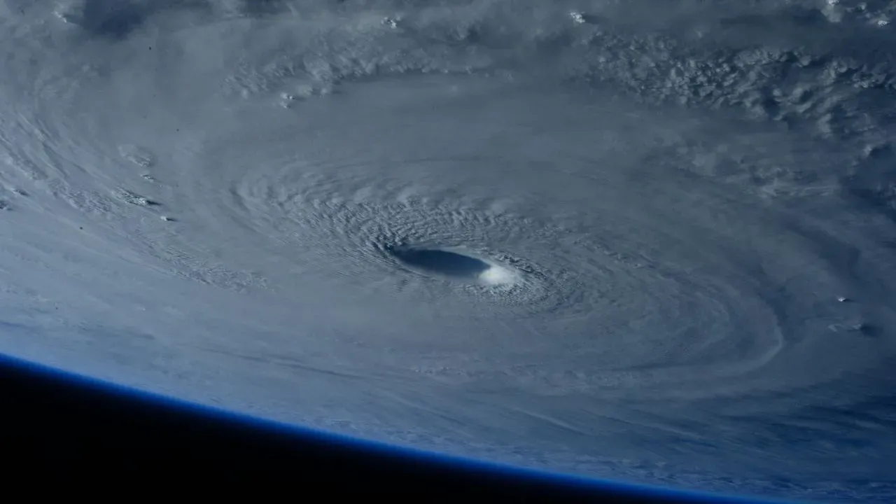

The Pacific waters south of Mexico have produced another striking example of how quickly tropical systems can organize. What the National Oceanic and Atmospheric Administration described as a “tropical disturbance” on a recent Sunday afternoon received the name Polo by the following day and reached Category 5 intensity within roughly 48 hours. Satellite imagery captured the compact, well-defined eye that formed as the storm drew energy from unusually warm sea-surface temperatures. For anyone with plans along Mexico’s Pacific shoreline, the episode underscores the value of staying connected to official sources rather than relying on scattered social-media updates. ([1])
How the Storm Developed
Forecasters noted the system’s rapid organization once it moved over favorable conditions. The transition from an unnamed disturbance to a named hurricane, and then to major-hurricane status, occurred in a compressed window that surprised even seasoned meteorologists. Warm ocean temperatures and light wind shear allowed the circulation to tighten and deepen quickly, producing the symmetric cloud pattern visible from space.
Travelers who follow Pacific Mexico routes know these late-season systems can still form when sea temperatures remain elevated. The timeline serves as a reminder that monitoring begins well before a storm receives a name.
Regions Most Likely to Feel Effects
Initial forecasts placed the core of the system well offshore, yet outer rain bands and elevated surf can reach coastal communities from southern Baja California Sur through parts of Colima and Jalisco. Resorts and smaller coastal towns in these areas often experience increased wave action and localized downpours even when the center stays at sea.
Airports serving popular destinations such as Cabo San Lucas, Puerto Vallarta, and Manzanillo typically continue operations unless crosswinds or heavy rain directly affect runways. Checking flight status directly with carriers remains the most reliable step when conditions shift.
Practical Steps for Travelers
- Register with the Smart Traveler Enrollment Program (STEP) through the U.S. Department of State or the equivalent service from your home country to receive official alerts.
- Bookmark the National Hurricane Center’s Pacific basin page and your resort’s direct contact line for real-time updates.
- Review flexible booking policies; many major hotel groups along the Pacific coast extend change windows during active watches without penalty.
- Pack a small essentials kit that includes a portable charger, copies of important documents, and any necessary medications in case of brief power interruptions.
Where to Find Reliable Information
Official channels remain the clearest path through uncertainty. The National Hurricane Center issues regular advisories that include projected tracks and intensity forecasts. Mexican meteorological services and local civil-protection agencies provide Spanish-language updates tailored to specific states and municipalities.
Resort concierges and destination-management companies also maintain direct lines to these agencies and can translate guidance for guests. Relying on a single verified source reduces the chance of misinformation spreading through unofficial channels.
Seasoned travelers understand that the ocean’s power commands respect, yet preparation and timely information allow most itineraries to continue safely. Keeping a flexible mindset and staying in touch with trusted authorities turns an unpredictable weather event into a manageable part of the journey.
AI Disclaimer: This article was created with the assistance of AI tools and reviewed by a human editor.