

The Numbers Don’t Lie: Rome’s Latitude in Context

Rome, the capital of Italy, is positioned at a latitude of approximately 41.9° N. New York City sits at about 40.71° N, making it one of the closest major American cities in latitudinal terms. The difference is real, if modest on paper. In climate terms, though, what happens at those coordinates is anything but modest.
Rome shares its parallel with Chicago, while Madrid sits at virtually the same latitude as New York, despite their wildly different climates. These alignments are startling precisely because the weather in those paired cities feels so completely unrelated to each other.
Chicago and Rome: Same Line, Very Different Winters
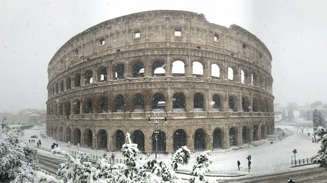
The latitude of Chicago, Illinois is 41.88° N, which is nearly identical to Rome’s 41.89° N. Yet due to its elevation and proximity to Lake Michigan, Chicago typically experiences colder winters than Rome. Far colder, in fact, by any practical measure.
Winter in Rome is notable for its mildness. Average temperatures from December to February fluctuate from around 8.4°C in January to 9.8°C in December. Chicago, by contrast, regularly sees temperatures well below freezing for weeks at a time. Same latitude, completely different story.
What the Mediterranean Actually Does for Rome

Rome experiences a hot-summer Mediterranean climate, classified under the Köppen system as Csa: summers are hot and dry while winters are mild and wet. The sea isn’t just scenery here. It’s an active climate force that shapes the city’s entire seasonal rhythm.
The European continent is also warmer because it is relatively narrow and surrounded by water. Simply being next to an ocean makes a big difference, because water can store so much heat. It builds up and stores heat in the summer, which it then releases to the atmosphere in winter. Rome benefits from exactly this effect through its proximity to the Tyrrhenian Sea, roughly 25 kilometers to the west.
Rome’s Actual Temperatures Through the Year

The hottest months in Rome are July and August, when average daily temperatures hold around 26°C, with maximum values regularly reaching and exceeding 30.9°C. The coolest period is January, with an average air temperature of 8.4°C and daytime maximums rarely exceeding 12.1°C. That winter pattern would feel remarkably mild to anyone who grew up in New York or Chicago.
Rome receives around 2,473 hours of sunshine per year. July is the sunniest month with 332 hours, while December is the cloudiest with just 112 hours. Even in its quietest season, the city holds onto a character that northern European capitals can only dream about in January.
The Alps: Europe’s Hidden Climate Wall

One factor that rarely makes it into casual conversations about European weather is the role of mountain geography. The Alps form a massive physical barrier along northern Italy, and their presence directly shapes what Rome’s winters feel like.
In a word: the Alps. They deflect the cold north wind from Italy. Being surrounded by the waters of the Mediterranean also moderates temperatures. Without that mountain shield, Rome’s winters would look dramatically different on the thermometer. The Apennines, running down Italy’s spine, add a further layer of eastern wind protection.
The Gulf Stream’s Role, and Where the Story Gets Complicated

The Gulf Stream is nicknamed “Europe’s central heating,” because it makes Europe’s climate warmer and wetter than it would otherwise be. This is the version of the story most people know, and it carries enough truth to feel satisfying. The fuller picture, however, is more nuanced.
Research has suggested that oceanic heat transport alone does not fully account for the difference between winter climates of western Europe and eastern North America. The temperature difference is also caused by the seasonal absorption and release of heat by the ocean and the moderating effect this process has on maritime climates downwind. The Gulf Stream matters, but it shares credit with broader atmospheric and oceanic dynamics.
Westerly Winds and Why They Change Everything

The true engine of regional climate is a combination of ocean currents and prevailing winds. Western Europe is the primary beneficiary of a massive oceanic conveyor belt that carries warm tropical waters across the North Atlantic, significantly tempering European winters. Those prevailing westerlies carry Atlantic warmth directly onto the European landmass before it can dissipate.
In contrast, the East Coast of North America is influenced by cold currents like the Labrador Current, which funnels Arctic air southward. This creates the harsh, biting winters typical of New York and Chicago. The asymmetry is striking: same latitude, but one continent gets warmed from the west by the ocean, and the other gets chilled from the north by continental air masses.
London Is at the Same Latitude as Calgary

Rome isn’t the only example worth considering. The broader pattern shows up across the entire continent. Toronto sits at the same latitude as Marseille in the south of France, making Toronto south of the French Riviera in geographic terms. London sits just north of Calgary, Alberta. These comparisons strain the imagination, but the coordinates are accurate.
Berlin, Germany; Calgary, Canada; and Irkutsk in the Asian part of Russia all lie on roughly the same latitude line. January temperatures in Berlin average around 8°C higher than those in Calgary, and they are nearly 22°C higher than average temperatures in Irkutsk. That’s not a small margin. That’s the difference between a livable winter and a genuinely brutal one.
Rome’s Rainfall: Wet Winters, Bone-Dry Summers

The weather in Rome is pleasant and sunny overall, as the city receives an average of around 800 mm of rainfall per year, mainly in the autumn and winter months, while rain from June to August is almost non-existent. This wet-winter, dry-summer rhythm is the defining signature of a Mediterranean climate, and it shapes everything from the vegetation to the pace of city life.
In the wettest month, November, Rome receives heavy rainfall averaging around 164 mm over roughly 15 rainy days. In contrast, the driest month, July, brings less than 17 mm over just 4 rainy days. For a city sitting at nearly the same latitude as Chicago, that summer dryness is remarkable. Chicago gets thunderstorms all summer long.
What This Means for How We Understand European Travel

Latitude is a major factor in solar intensity, but it is not the only constituent. Factors such as elevation, ocean currents, and inland versus coastal position play an important role in determining local climate. This is worth internalizing before packing a bag for any European destination, because assumptions built on latitude alone will lead you astray.
Europe does indeed experience milder climates and less intense temperature swings than other areas at similar latitudes. Despite its northern latitudes, Europe experiences less extreme temperature swings than parts of North America and the rest of northern Eurasia at similar latitudes. For travelers, this translates into something genuinely practical: European winters, even in cities that feel far north on a map, tend to be more forgiving than their coordinates suggest.
The Takeaway

Geography is full of these quiet corrections to our intuitions. Rome sitting north of New York isn’t trivia. It’s a window into the complex web of ocean currents, mountain ranges, prevailing winds, and continental geometry that produces the weather we experience every day.
The next time someone describes southern Italy as a place of lazy warmth while brushing off New York winters as a fact of northern life, the map tells a different story. It’s not about how far north you are. It’s about what surrounds you when you get there.
AI Disclaimer: This article was created with the assistance of AI tools and reviewed by a human editor.