
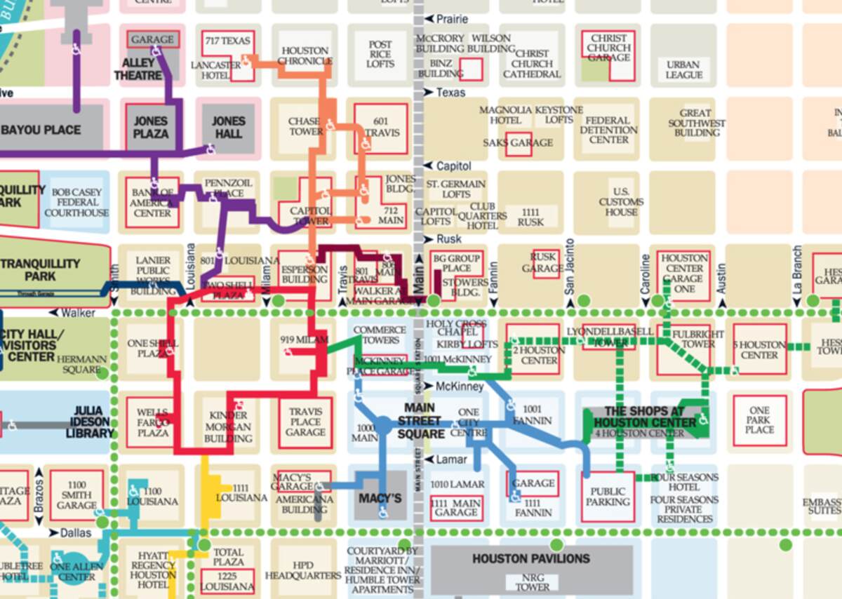
This is a map of the Houston Downtown Tunnel System, a vast underground network connecting office buildings, hotels, and retail spaces across multiple city blocks. Different colored pathways represent various tunnel routes, guiding pedestrians through key locations such as Main Street Square, The Shops at Houston Center, and Tranquility Park. Green dashed lines indicate pedestrian-friendly streets or above-ground connections. Red boxes highlight garages and parking facilities, ensuring accessibility for visitors commuting by car. The map showcases how the tunnels provide a climate-controlled, convenient way to navigate Houston’s downtown, particularly during extreme weather conditions.