


Most people who plan a road trip through Arizona have Route 66 circled on the map before they even pack a bag. It’s iconic, it’s nostalgic, and it has the kind of cultural gravity that’s hard to argue with. Historic Route 66 stretches from downtown Chicago to Santa Monica Pier in California, and since 1926, travelers have been hitting the 2,448-mile road that has more than 250 sites listed on the National Register of Historic Places.
Yet there’s another Arizona highway that quietly passes through ghost towns, red rock canyons, ancient ruins, and pine forests all in a single drive. Most road trippers either miss it entirely or only catch a small piece. That highway is State Route 89A, and the case for calling it more scenic than Route 66 is stronger than most people realize.
What Exactly Is State Route 89A?
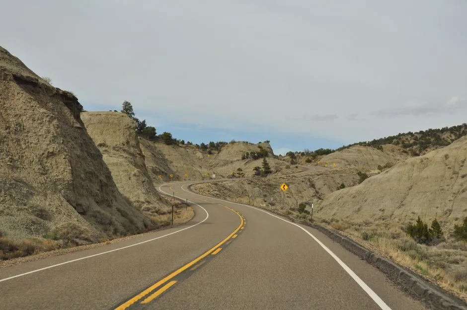
State Route 89A is an 83.85-mile state highway that runs from Prescott north to Flagstaff in Arizona. The highway is notable for its scenic value as it winds over and through Mingus Mountain as well as passing through Sedona and Oak Creek Canyon. It’s a compact drive compared to Route 66, but what it lacks in length, it more than compensates for in sheer landscape variety.
The road from Prescott to Flagstaff on Arizona Route 89A is among the most scenic drives in America. It is also a dramatic transition from Arizona’s central mountains to the Colorado Plateau. North between Sedona and Flagstaff, SR 89A passes through Oak Creek Canyon, one of the most scenic roads in the Grand Canyon State, and the first designated scenic road in Arizona.
How Route 66 Measures Up Inside Arizona
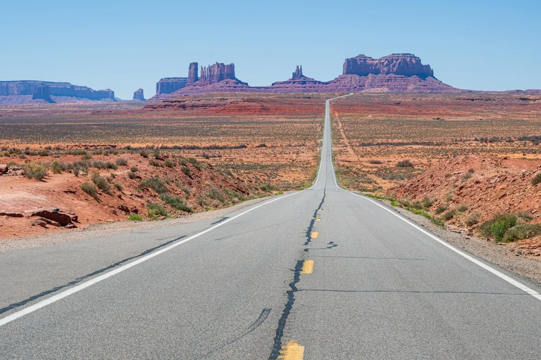
Route 66 is hard to find east of Flagstaff. Sometimes all that’s left is a decaying road a few hundred feet off Interstate 40. West of Ashfork, you can pick up Route 66 and drive it all the way into Kingman. The scenery is decidedly barren but it’s still a cool ride. That’s an honest assessment, and it matters when you’re comparing two drives on their actual merits.
Route 66 is a nostalgic road trip through quirky towns, historic landmarks, and vast desert scenery, and the stretch between Flagstaff and Kingman is one of the most picturesque, with stops like Williams and Seligman, known as the inspiration for Pixar’s Cars. The cultural pull is undeniable. The raw visual drama of the landscape, however, is a different conversation.
The First Major Act: Mingus Mountain and Jerome
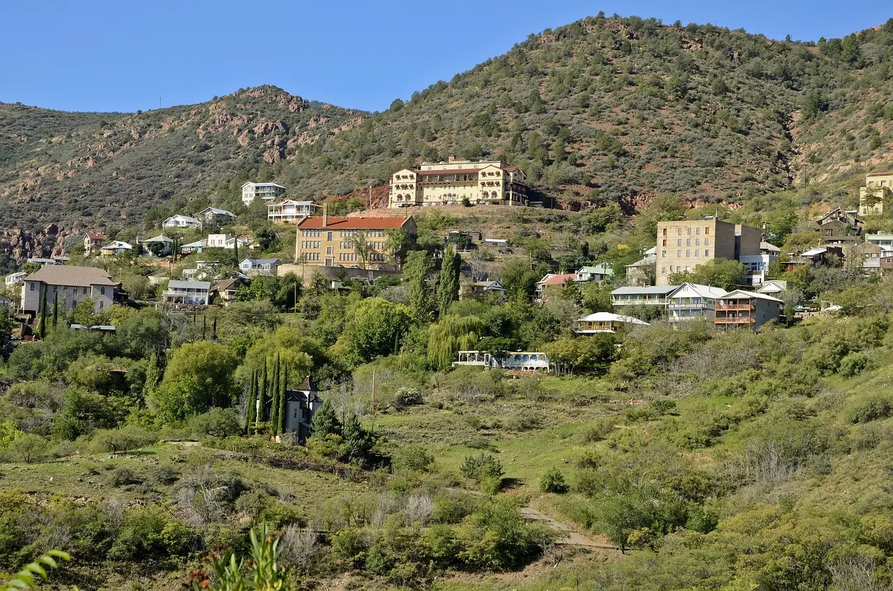
89A begins five miles north of Prescott and climbs to the top of Mingus Mountain. From there, the highway descends to Jerome and the Verde Valley. Jerome, Arizona, incorporated in 1899, is located approximately 100 miles north of Phoenix and 45 miles southwest of Flagstaff on State Highway 89A. The town sits perched on a hillside at an elevation of over 5,000 feet in the Black Hills of Arizona.
Once a booming copper mining town with 15,000 residents, Jerome clings dramatically to Cleopatra Hill in central Arizona. Buildings literally slid downhill due to mining blasts, including the famous “Sliding Jail.” Today, Jerome is a designated National Historic Landmark and a living piece of Arizona history. Its past is written in the bricks, timbers, and rusting mining equipment that dot the landscape, but it’s not just about the past – Jerome is alive with energy and artistic expression.
A Ghost Town That Refused to Die
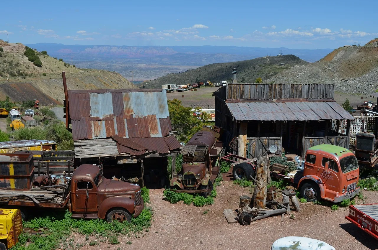
After its founding in 1876, Jerome was at one time the fourth largest city in Arizona, with the population peaking at around 15,000 in the 1920s. The end of the copper mining era in Jerome came in 1953 when Phelps Dodge closed the mines. About 800 million dollars in copper had been removed from the local mines by then, and Jerome nearly became a ghost town as most folks left, leaving only 50 residents.
In the 1960s and ’70s, artists, musicians, and craftspeople discovered the beauty and creative potential of this weathered town. They renovated crumbling buildings, opened galleries, and built a vibrant community out of the bones of the old mining days. At 5,000 feet, Jerome enjoys temperatures 5 to 10 degrees cooler than Phoenix, making July visits comfortable for gallery walks and outdoor exploration. That practical detail alone sets it apart from most desert stops on Route 66.
Driving Into the Verde Valley
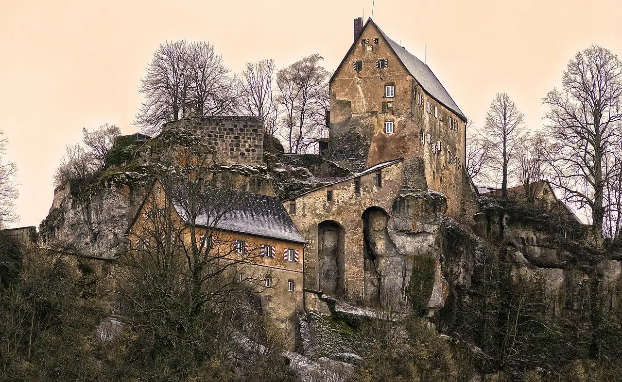
Located on the south side of the Verde Valley, Jerome, Clarkdale and Old Town Cottonwood are linked to the history of copper mining in the area. Tuzigoot National Monument, perched on a limestone ridge in Arizona’s Verde Valley near AZ Route 89A, preserves an ancient pueblo. Today the three towns attract tourists to art galleries, unique shops, fine restaurants and history museums.
Tuzigoot National Monument preserves a prehistoric pueblo built by a culture known as the Sinagua. The pueblo consisted of 110 rooms, including two and three-story structures. Visitors can learn about this prehistoric culture in the visitor center and then take a short hike through the ruins. It’s the kind of stop that adds genuine archaeological weight to the drive, something Route 66 doesn’t easily replicate in this stretch of the southwest.
Sedona: The Crown Jewel of 89A
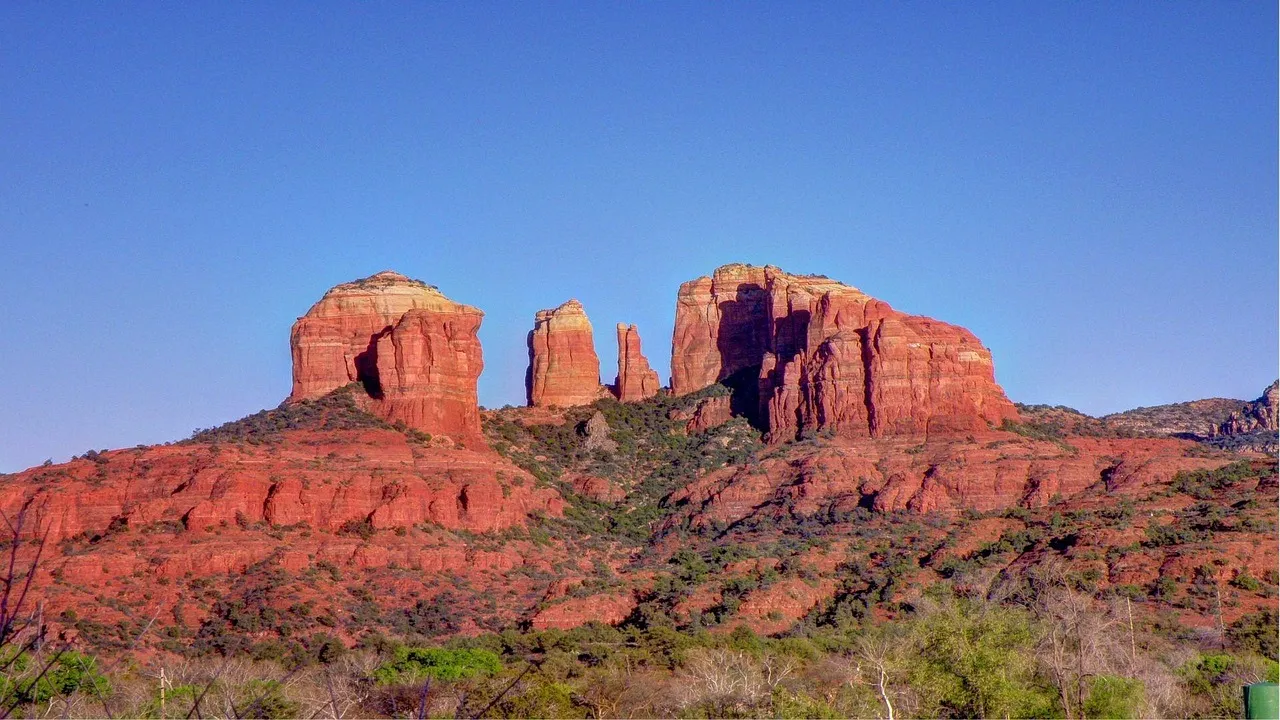
Located in one of the most beautiful settings in Arizona, Sedona is surrounded on three sides by red sandstone cliffs, buttes and canyons. Once a sleepy, artsy small town, it now draws tourists worldwide to art galleries, restaurants, and resorts. The road is very picturesque, with varying scenery ranging from red rocks to tree-covered mountains.
Those radiant red rocks, which change hues depending upon the time of day, form a stunning background to the delightful hotels, shops, and restaurants in Sedona. The Sedona area stretch of this drive has been heralded as one of the most beautiful in America. Traffic through Sedona’s center can be heavy during peak periods, so an early morning departure makes a real difference.
Oak Creek Canyon: Where the Road Gets Extraordinary
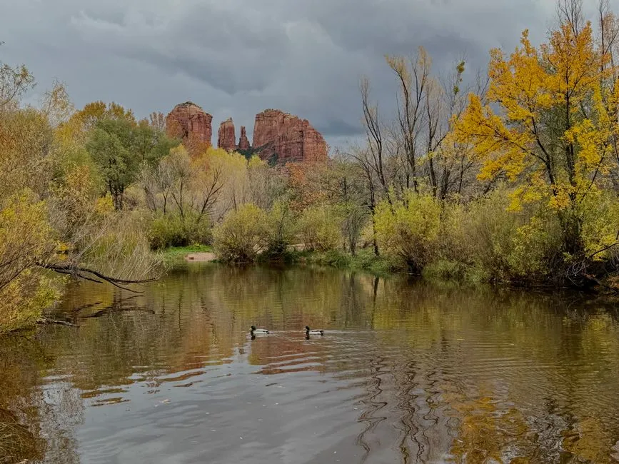
Located between Sedona’s red rock country and Flagstaff’s pine forests, Oak Creek Canyon is the star of Highway 89A road trips. Tight switchbacks wind through the canyon, encouraging visitors to slow down and soak it all in. The walls of Oak Creek Canyon tower 1,000 to 1,500 feet above the canyon bottom.
The drive begins in the pine forests, descends quickly through some winding hairpin turns, through the tree-lined section of Oak Creek, before finally emerging into the Red Rock Country of Sedona. The dramatic change in scenery is one that you have to see to believe. Upon leaving Sedona, SR 89A becomes the state-designated Sedona-Oak Creek Canyon Scenic Road. The highway heads northeast into a wooded area from Sedona and follows Oak Creek as it enters Oak Creek Canyon, providing access to Slide Rock State Park along this portion.
Slide Rock State Park: A Milestone on the Route
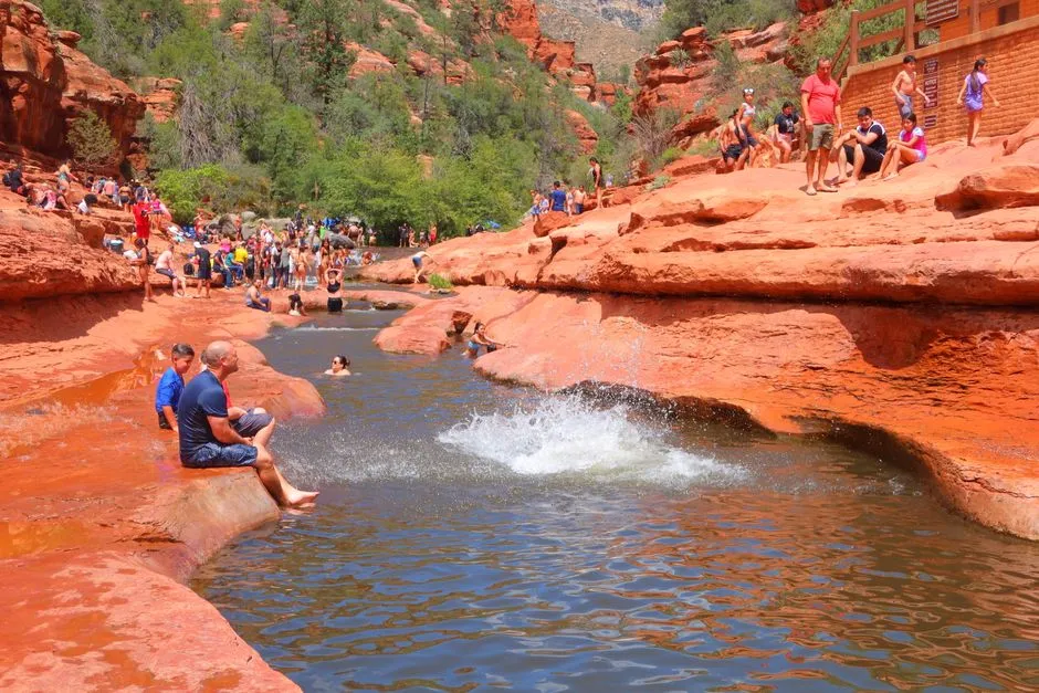
Slide Rock State Park is located in Oak Creek Canyon seven miles north of Sedona. It takes its name from a natural water slide formed by the slippery bed of Oak Creek. Slide Rock State Park is one of the most visited tourist attractions in Arizona, regularly attracting over a quarter of a million annual visitors, with 278,330 recorded in 2024. Those aren’t niche numbers.
An 80-foot stretch of Oak Creek rushes through a narrow red-rock flume at Slide Rock State Park, where visitors are whisked down an incline into a cold pool. The natural water slide sees most of the action, but trails lead to wading pools and fishing holes along a half-mile stretch of Oak Creek. The park has also been a featured location in numerous Hollywood Westerns from the 1950s, including Broken Arrow starring James Stewart and Gun Fury starring Rock Hudson and Donna Reed.
The Practical Reality of Driving 89A
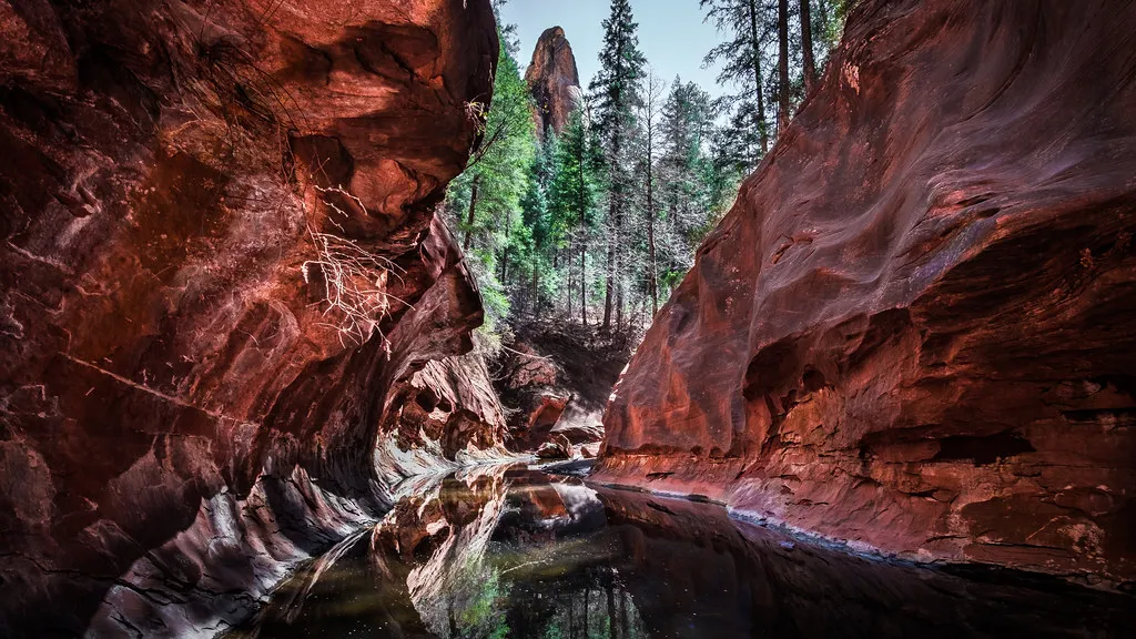
This is a very scenic drive with changing scenery along the way. Some parts of the drive are steep and have switchbacks and are not recommended for longer RVs. Trucks over 50 feet long are prohibited from Oak Creek Canyon due to the narrow and winding course SR 89A takes. This is worth knowing before you load up a big rig or a large trailer.
Climbing out of Oak Creek Canyon, SR 89A navigates through a series of hairpin turns by the mouth of Sterling Canyon. SR 89A rapidly gains 800 feet in elevation as it climbs onto the Kaibab Plateau. The elevation shift alone is a visual spectacle, going from desert canyon floor to pine-covered plateau in a matter of miles. Very few American roads compress that kind of geographic change into such a short distance.
The Verdict: Does 89A Outshine Route 66?
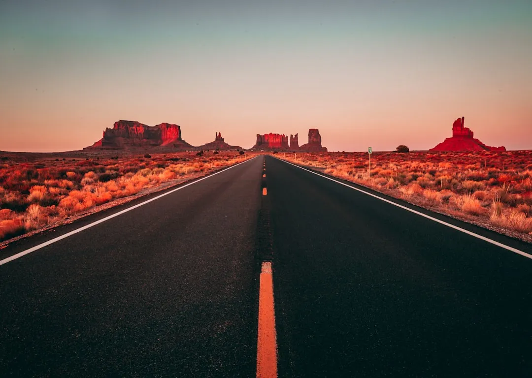
Comparing these two roads isn’t entirely fair because they’re after different things. Route 66 is a cultural artifact, a road that carries American mythology in its asphalt. Route 66 is a smooth ride on a paved highway, making it ideal for classic road trip vibes, with local shops and roadside attractions that make it a living piece of Americana. That has real, lasting appeal.
Few roads in Arizona have as much variety in landscape, flora and recreational activities as State Route 89A. Stretching from Flagstaff to Prescott, segments of this road are considered a must-do for anyone seeking some of the most scenic views found in Arizona outside of the Grand Canyon. The evidence stacks up consistently: ghost towns, ancient pueblos, red rock formations, canyon walls over a thousand feet high, a natural waterslide drawing nearly 280,000 people annually, and a transition from desert to alpine forest all within roughly 84 miles.
Route 66 is worth driving for what it represents. SR 89A, though, is worth driving for what you actually see out the windshield. If scenic beauty measured in pure landscape is the yardstick, this overlooked Arizona highway has a genuine and well-documented claim to the top spot.
AI Disclaimer: This article was created with the assistance of AI tools and reviewed by a human editor.