
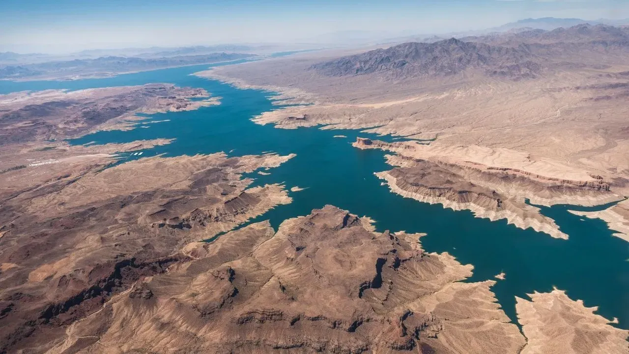

The combined contents of Lake Powell and Lake Mead have not been this low since before Lake Powell began filling after Glen Canyon Dam was completed in the 1960s. Federal officials have now finalized operating guidelines for 2027 and 2028 that reduce deliveries from the Colorado River to Arizona, California, and Nevada by a combined 1.25 million acre-feet each year. The measures aim to safeguard the reservoirs and the hydropower they support while the drought persists across the Southwest.
Travelers drawn to these iconic desert waterways will notice shifting shorelines and changing access points in the seasons ahead. The new framework gives the Department of the Interior tools to adjust releases and protect critical infrastructure, yet the landscapes remain open for thoughtful exploration.
The Scale of the Reductions
Arizona faces the largest share of the cuts at 760,000 acre-feet annually, followed by California at 440,000 acre-feet and Nevada at 50,000 acre-feet. These amounts represent meaningful portions of each state’s apportionment and will begin in 2027. The Interior Department is also seeking at least 700,000 acre-feet of additional voluntary conservation across the Lower Basin during the same period.
Upper Basin states – Colorado, New Mexico, Utah, and Wyoming – face no mandatory cuts. Instead, they are asked to coordinate on releases from federal reservoirs to help stabilize Lake Powell and Glen Canyon Dam. The two-year guidelines allow flexibility for further adjustments if conditions change.
Shifting Conditions at the Reservoirs
Lake Powell is projected to start the 2027 water year between elevations of 3,540 and 3,510 feet, with releases limited to between 6 million and 7 million acre-feet initially. The goal is to keep the reservoir at or above 3,510 feet to maintain dam operations. Lake Mead, the nation’s largest reservoir by capacity, will see reduced inflows as a direct result of the Lower Basin cuts.
These elevations influence marina operations, boat ramp usability, and the distance visitors must travel from shore to reach deeper water. Houseboating routes, fishing spots, and shoreline camping areas may require updated planning as the water recedes.
Practical Steps for Responsible Visitors
Travelers can still enjoy the dramatic canyons, clear night skies, and quiet coves that define these places. Checking current water levels and marina status through official National Park Service channels before departure helps avoid surprises at the ramps. Choosing shoulder seasons or midweek visits spreads use more evenly across the year.
Many marinas and outfitters already adapt equipment and launch points as levels fluctuate. Renting smaller craft or joining guided tours led by local operators often provides the most current knowledge of safe routes and protected areas. Packing out all waste, staying on established paths, and respecting temporary closures around sensitive shorelines supports the long-term health of the ecosystem.
Looking Ahead on the Colorado River
The guidelines prioritize voluntary cooperation among the seven basin states, tribal governments, and Mexico while preserving federal authority to respond if levels drop further. Negotiations for longer-term management continue beyond 2028. For now, the focus remains on keeping the river system functional for the millions of people, farms, and communities that depend on it.
Visitors who approach these reservoirs with patience and preparation will continue to find extraordinary beauty in the red-rock country. The changing water levels invite a deeper appreciation for the desert’s resilience and the careful choices that sustain it for future journeys.
AI Disclaimer: This article was created with the assistance of AI tools and reviewed by a human editor.