
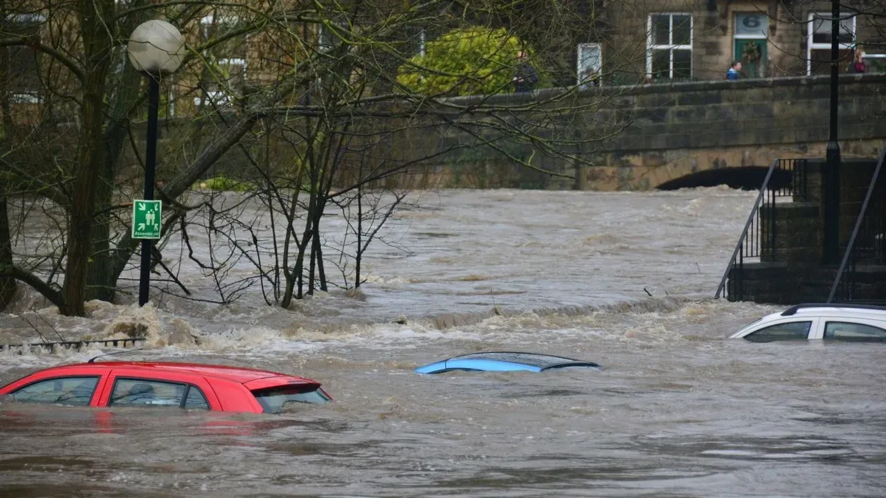

New York – A strong nor’easter has brought periods of heavy rain, coastal flooding, and gusty winds to parts of the Northeast over the weekend, with additional effects expected through Monday. The system has prompted states of emergency in affected areas of New York and New Jersey, where low-lying roads and waterfront neighborhoods have seen significant water accumulation. Travelers planning trips through the region will benefit from monitoring conditions closely as the storm continues its path.
Current Weather Patterns Along the Coast
The nor’easter has lingered offshore before shifting inland, delivering repeated rounds of precipitation that have led to flash flooding in urban and coastal zones. In New York and New Jersey, streets in several communities have required alternative navigation, with some residents using small boats to move through inundated areas. Wind speeds have reached notable levels in spots, contributing to power disruptions for tens of thousands of households across the tristate area. These conditions align with forecasts that anticipated the storm’s peak influence around high tide cycles. The combination of rainfall and onshore flow has kept coastal waters rough, limiting beach access in places where rip currents pose additional concerns.
Travel Considerations for the Region
Road conditions remain a primary factor for anyone driving into or through New York and New Jersey. Flooded roadways can appear suddenly, particularly near streams, low-lying coastal routes, and urban underpasses, so checking real-time updates from state transportation departments is advisable before departure. Air travel may also experience delays or cancellations as airlines adjust schedules around wind and visibility issues at major airports serving the Northeast. Passengers with upcoming flights should confirm status directly with carriers and allow extra time for ground transportation to terminals. Rail and ferry services along the coast have likewise faced interruptions where tracks or docks encounter high water. Those relying on public transit or intercity connections will find the most reliable information through official operator channels rather than general assumptions.
Looking Ahead Through the Week
Meteorologists expect the nor’easter to continue delivering rain across mid-Atlantic and northeastern states into Monday night before gradually weakening. Additional localized flooding remains possible in inland sections of New Jersey and farther north, while wind gusts could still affect exposed areas through the early part of the week. Travelers already in the region or preparing to arrive can support local communities by following evacuation guidance where issued and avoiding unnecessary travel during peak storm periods. Checking official sources such as the National Weather Service and state emergency management offices provides the clearest picture of evolving conditions. ([1])
AI Disclaimer: This article was created with the assistance of AI tools and reviewed by a human editor.