

There’s a corner of Missouri that most people overlook on the way somewhere else. The southern half of the state, carved and sculpted over millions of years, holds one of North America’s most quietly spectacular landscapes. Limestone bluffs rise from river valleys, springs the color of a summer sky push millions of gallons of ice-cold water out of the earth, and rivers run clear enough to count the pebbles on their beds.
This is the Missouri Ozarks. It doesn’t announce itself loudly. It rewards patience, a willingness to drive a gravel road, and a curiosity about what hides beneath the surface of things. The travelers who find it tend to come back.
A Landscape Born Beneath the Surface
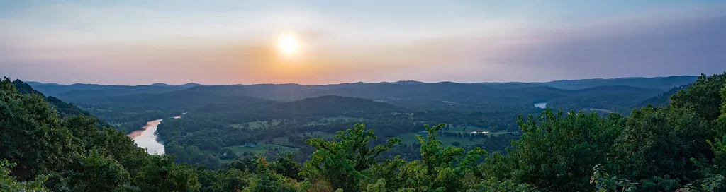
Between the outcroppings and bluffs of this 47,000-square-mile region, rivers and streams have carved countless canyons and caverns, creating a gorgeous wilderness with tremendous variety of outdoor activities. The geology here tells a long, slow story. The Ozark Mountains are made up mostly of limestone, and after enough years, it erodes in odd patterns, creating fissures and sinkholes that swallow up rainwater. Gravity pushes that water lower and lower into caverns, underground stream beds where it courses along. Eventually that hidden water finds a way out, bursting back into the light as a spring.
The Ozark Mountains, stretching from St. Louis to the southernmost part of the state near Arkansas, are part of a larger mountain range that also covers parts of Arkansas, Illinois, and southeastern Kansas. The Ozark and adjacent Ouachita Mountains are unique because they are the only significant areas of rugged topography between the Rockies and Appalachians.
Over 4,400 Springs Hidden Across Southern Missouri
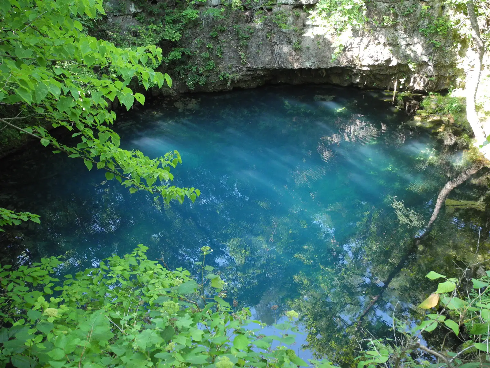
The Show-Me State has one of the highest concentrations of freshwater springs in the United States. More than 4,400 springs are located across southern Missouri, primarily in the rugged terrain of the Ozarks, ranging in size from tiny trickles to pools more than 50 feet in diameter. The numbers are staggering, and yet many of these springs remain genuinely off the beaten path.
The cold-water springs originate hundreds of feet below ground and maintain an average temperature of 56 to 58 degrees year-round. The high mineral content, depth, and clarity of the water give springs their vibrant color, shades of blue that range from teal to turquoise. That steady cold temperature makes them especially magnetic during Missouri’s humid summers.
Big Spring: One of the Largest in the United States
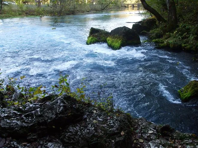
The aptly named Big Spring near Van Buren is not only the largest spring in Missouri, but it is also considered one of the three largest springs in the United States. The scale is almost hard to take in at first glance. The enormous amount of water emerging from an underground cave churns and tumbles into fast-moving cascades, then flows into a wide pool that, in the right light, looks sky blue as it rushes toward the Current River.
Big Spring in Missouri averages an output of 289 million gallons of water daily. A short, wheelchair-accessible path leads visitors directly to a viewing platform, and nearby trails climb the ridge above for elevated views of the spring and surrounding forest. The Big Spring Lodge is one of many Civilian Conservation Corps buildings that have been renovated, starting in 2022, giving the historic site a renewed sense of presence alongside its natural wonders.
Blue Spring: The “Spring of the Summer Sky”
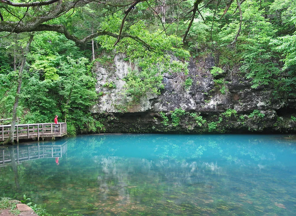
The Osage Indians reportedly called this spring “Spring of the Summer Sky,” a name that makes complete sense the moment you see it. With a depth of over 310 feet, Blue Spring is one of the deepest springs in the country. The depth, combined with the mineral-rich spring water, creates a vibrant blue color. Nothing about it looks real until you’re standing on the wooden deck above the pool.
If you were to submerge the Statue of Liberty in the 310-foot-deep pool, her torch would be five feet below the surface of the water. Blue Spring is the sixth largest spring in the state with a daily discharge of 90 million gallons of water per day. The 17-acre area around it has been designated as a Missouri Natural Area for its biodiversity, managed jointly by the Missouri Department of Conservation and the National Park Service.
The Current and Jacks Fork: America’s First Protected River System
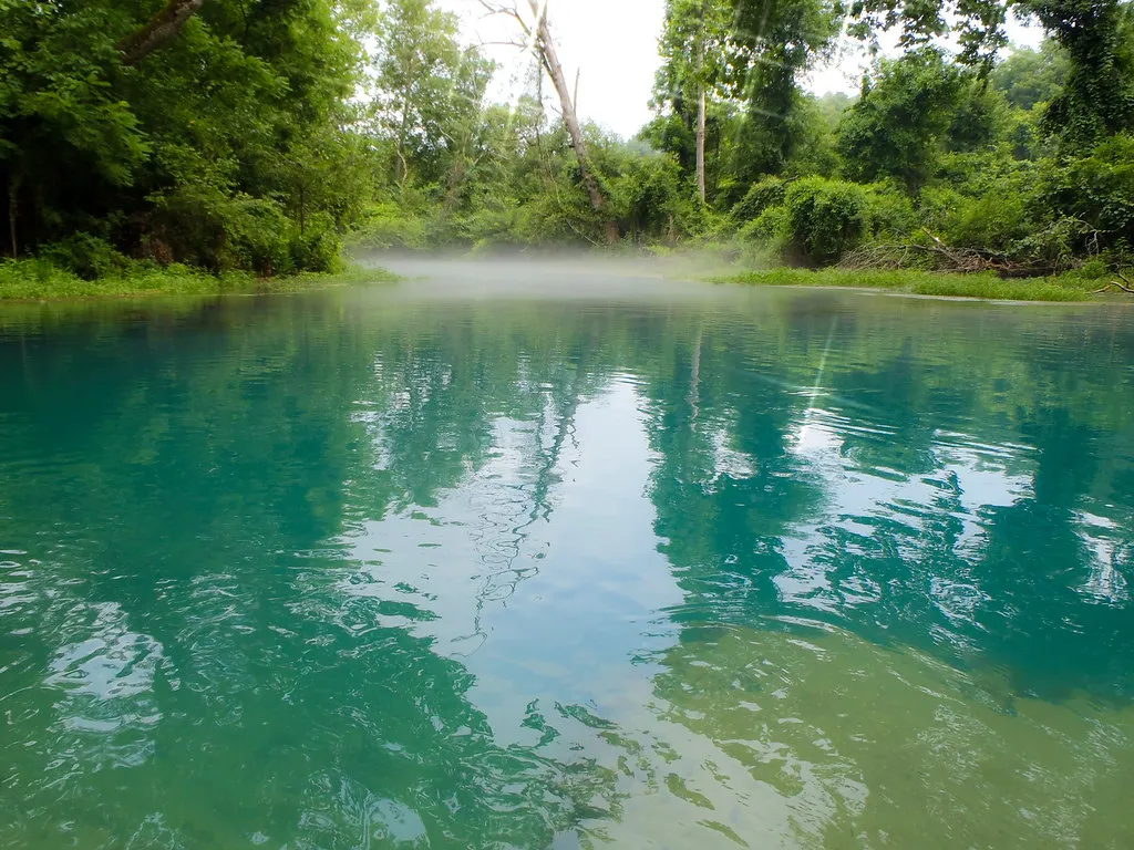
Ozark National Scenic Riverways is the first national park area to protect a river system. The Current and Jacks Fork rivers are two of the finest floating rivers found anywhere, spring-fed, cold and clear, a delight to canoe, swim, boat, or fish. That designation, earned in 1964, helped preserve a stretch of Missouri that might otherwise have been dammed or developed beyond recognition.
Ozark National Scenic Riverways preserves 134 miles of the free-flowing Current and Jacks Fork rivers, the surrounding resources, and the unique cultural heritage of the Ozark people. As you float downstream, you pass dense forests, towering bluffs, and gravel banks, which are perfect for the occasional snack or lunch break. There’s a rhythm to a river float here that’s hard to replicate anywhere else.
The Eleven Point: A Wild and Scenic Original
The Eleven Point River offers class I and II rapids depending on the season and recent rainfall, making it an ideal location for paddlers with some experience. The river is fed by Greer Spring, the second largest spring in the state, pumping more than 200 million gallons of water into the waterway each day. That volume of input transforms the river’s character, giving it a clarity and volume that feel almost otherworldly.
The Eleven Point is one of the eight original rivers to be included in the United States Wild and Scenic River System. That federal protection has kept the corridor genuinely wild. More than two dozen rivers in Missouri offer float trips that range from a few hours to multi-day adventures, and local outfitters can supply all the equipment you need, including canoes, kayaks, rafts, tubes, paddles, and life jackets.
Alley Spring and the Historic Mill
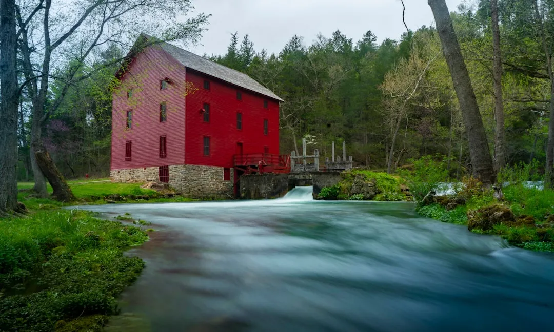
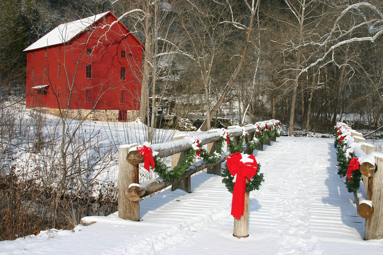
Alley Spring, Missouri’s seventh-largest spring, pumps out more than 80 million gallons of water each day. It sits five miles west of Eminence and has long been a gathering place for people drawn to the water. Historic Alley Mill sits at the edge of the teal-blue spring and is one of the most photographed spots in Missouri. The grounds include picnic areas, a historic one-room schoolhouse, and a restored general store.
The three-quarter-mile Spring Branch Trail circles the spring, while the Alley Spring Overlook Trail, a 1.5-mile loop, includes a steep climb to an overlook with views of the valley. The mill itself dates to the 1890s, and it sits there against the teal water like something a painter invented. It’s genuinely one of the most striking historic scenes in the entire Midwest.
The Ozark Trail: More Than 430 Miles of Bluffs and Wilderness
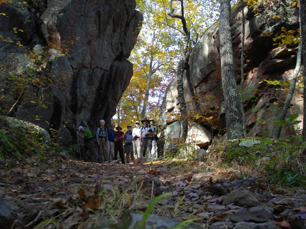
The Ozark Trail contains over 430 miles of trail divided into 14 mostly connected sections throughout southeast Missouri. The established thru-hike covers eight of the connected sections, running from Onondaga Cave State Park in Leasburg, roughly 84 miles southwest of St. Louis, to the Eleven Point terminus near Thomasville, 23 miles north of the Arkansas border.
Along the Ozark Trail, you’ll encounter waterfalls, crystal-clear streams, swimming holes, rocky outcroppings, bluffs, caves, shut-ins, prairies, wetlands, and dense forests, all supporting the native flora and fauna that live in these varied habitats. You can watch beavers build lodges, hear an elk bugle, travel through hardwood forests and near-vertical bluffs, ford crystal-clear streams, and pause on rocky balds with impressive views. These places are home to deer, turkey, bobcats, bears, and bald eagles.
The Economic Pulse Behind the Natural Beauty

A National Park Service report released in September 2024 shows that 1.3 million visitors to Ozark National Scenic Riverways in 2023 spent $66.8 million in communities near the park. That spending supported 908 jobs in the local area and had a cumulative benefit to the local economy of $76.8 million. For a largely rural stretch of south-central Missouri, those numbers represent a meaningful portion of the regional economy.
According to a 2019 report, overall economic impact from tourism in the Ozarks grew from $12.9 billion dollars in 2009 to $17.7 billion dollars in 2019, and over 300,000 jobs were created in the industry in that year alone. Compared to other Midwestern states, Missouri is the leader in tourism revenue with Illinois ranking a distant second. The Ozarks sit at the center of that story.
Ha Ha Tonka State Park and the Castle on the Bluffs
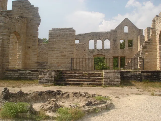
Follow the 1.4-mile Spring Trail to reach Ha Ha Tonka Spring, Missouri’s twelfth largest spring, located in Ha Ha Tonka State Park at Lake of the Ozarks. The trail starts at the edge of the lake and travels alongside rock bluffs to the spring, which has an average daily flow of 58 million gallons of water. Beyond the spring, the loop trail ascends 316 steps and provides spectacular views.
The park includes more than a dozen hiking trails, fascinating geological features including a natural bridge and sinkholes, and the remains of a historic stone “castle” built in the early 1900s. That castle, now a ruin, was once a private vacation estate. Perched above the lake on a limestone bluff, its stone walls still stand like a scene borrowed from another continent. It’s a reminder that the Ozarks have always had a way of inspiring people to build something grand in their presence.
The Missouri Ozarks don’t need much promotion. They’ve been quietly doing their work for millions of years, pushing cold water up through limestone, carving bluffs, and keeping the rivers honest. Anyone willing to follow a gravel road past the last highway sign tends to discover that for themselves.
AI Disclaimer: This article was created with the assistance of AI tools and reviewed by a human editor.