
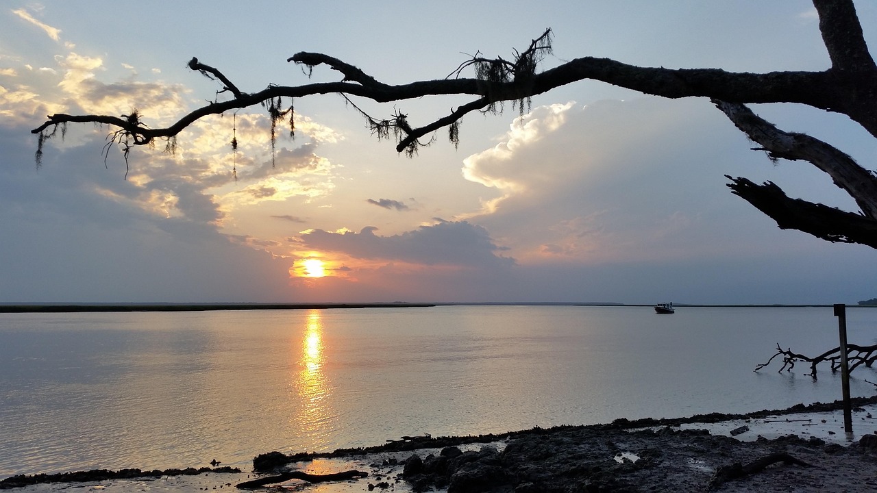

There’s a particular kind of quiet that settles over Georgia’s coast once you leave the mainland behind. No highways hum in the distance, no strip malls interrupt the marsh grass, just tide pools, palmetto thickets, and the occasional distant call of an osprey. Somewhere along this stretch of shoreline sits a barrier island that has managed to stay almost exactly as it was a century ago, and the story of how that happened is worth slowing down for.
A Barrier Island Like No Other
Cumberland Island sits at the southernmost tip of Georgia’s coast, reached by ferry from the small town of St. Marys near the Florida line. It is Georgia’s largest and southernmost barrier island, stretching nearly 18 miles and encompassing more than 36,000 acres of dunes, maritime forests, marshes, and beaches. Of that total acreage, a surprising amount is actually water and wetland rather than dry land. Cumberland Island is 17.5 miles long and totals 36,415 acres, of which 16,850 are marsh, mud flats, and tidal creeks. That balance between land and water is part of what gives the island its layered, ever-shifting character.
Nearly Eighteen Miles of Undeveloped Beach
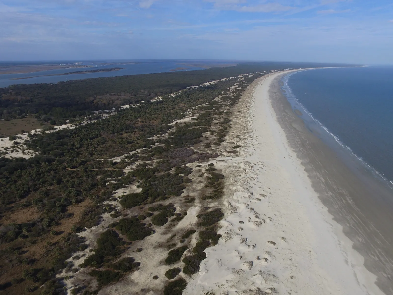
The number that draws most people’s attention, though, is the beach itself. Cumberland Island National Seashore encompasses nearly 18 miles of undeveloped beach offering recreation for visitors and essential nesting area for birds and sea turtles. Local guides describe it plainly and accurately. At 17 miles long, Cumberland Island’s beach is the longest stretch of undeveloped beach on the east coast. Even among Georgia’s own barrier islands, which include Jekyll, St. Simons, and Sapelo, Cumberland stands apart. It certainly has the longest beach, with 17.5 miles, and the most upland acreage with 15,100. No high-rises interrupt the view, no boardwalks with souvenir shops, just sand, dune grass, and the horizon.
A National Seashore Born from Compromise
Cumberland’s protected status didn’t happen automatically, and it very nearly didn’t happen at all. In 1968, Carnegie family descendants sold a large portion of the island to a real estate developer with plans that could have transformed it entirely. Plans to create a National Seashore were complicated when, in October 1968, Carnegie descendants sold three thousand acres of the island to real estate developer Charles Fraser, who had developed part of Hilton Head Island, South Carolina.
Fraser met with conservationist and then Sierra Club executive director, David Brower, on the island to discuss how to develop the area. Their negotiations, later documented in John McPhee’s writing, produced a compromise that shaped the island’s future. Brower pushed for a 90/10 split, with 90% of the land to remain undeveloped. Congress made the protection official not long after. The national seashore was authorized by Congress on October 23, 1972, and is administered by the National Park Service.
The Carnegie Legacy and the Ruins of Dungeness

Long before conservationists arrived, the Carnegie family had already left a permanent mark on Cumberland Island. Starting in the early 1880s, steel magnate Thomas Carnegie and his wife Lucy began acquiring land, eventually controlling most of the island. In the early 1880’s Pittsburg steel magnate Thomas Carnegie and his wife Lucy began buying up the island as a southern retreat.
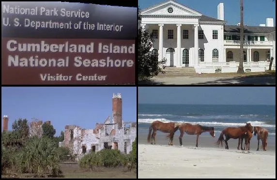
They would eventually own 90 percent of Cumberland, which is a third larger than the island of Manhattan. Their grand mansion, Dungeness, once anchored the island’s social life before fire reduced it to ruins in 1959, and those blackened walls still stand today as one of the island’s most photographed sights. Walking the Dungeness trail now, visitors pass carriage houses, servants’ quarters, and a small family cemetery, all quiet reminders of a Gilded Age retreat that outlasted its own grandeur only in fragments.
Wild Horses on a Wild Coast
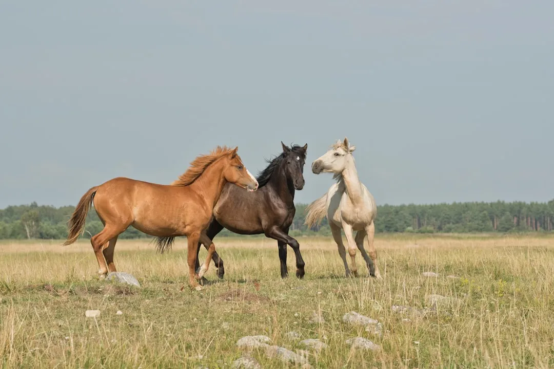
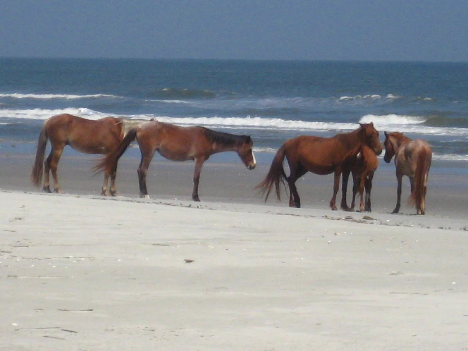
No feature of Cumberland Island draws more curiosity than its feral horses, which graze freely across dunes, marshes, and the Dungeness ruins. Despite popular legend crediting Spanish explorers, the more likely story involves later English settlers. It is unlikely that any horses left by the Spanish survived, and more likely the current population descends from horses brought to the island in the 18th century by the English.
Today’s herd numbers roughly between 150 and 200 animals. There is estimated to be a population of between 150 and 200 horses on the island. What makes this herd genuinely unusual is its complete independence from government oversight. Cumberland Island is home to the only herd of feral horses on the Atlantic Coast that is not managed by the Bureau of Land Management.
A Refuge for Sea Turtles
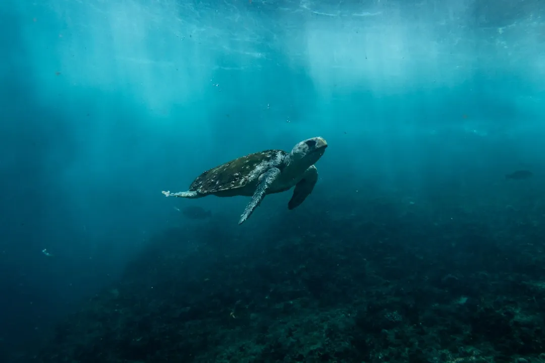
Cumberland’s long, undisturbed beach isn’t just scenic, it’s functionally critical for one of the ocean’s most vulnerable travelers. Loggerhead sea turtles return to these same sands year after year to nest, and the numbers have been remarkable in recent seasons. Cumberland Island is sheltering 1,026 of these nests, all but six of which are loggerhead nests, making the island’s 18-mile undeveloped beach one of the most important loggerhead sea turtle nesting areas in Georgia.
That single island carries an outsized share of the state’s entire nesting effort. Each year the island accounts for 25 to 30 percent of the statewide nesting total. Without the beach’s protected, undeveloped condition, that kind of nesting success simply wouldn’t be possible.
Twenty-Three Ecological Communities in One Place
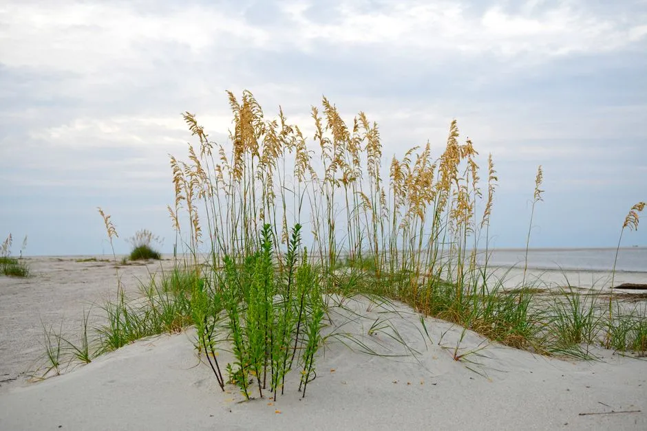
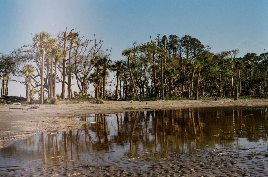
Beyond the horses and the turtles, Cumberland Island functions as a genuinely complex ecosystem, not just a pretty backdrop. Researchers have identified an unusually high number of distinct habitats packed into its acreage. The park contains at least 23 distinct ecological communities, making it the largest and most biodiverse of Georgia’s barrier islands.
A significant portion of that land has also been set aside under the strictest federal protection available. Cumberland Island is also home to over 9,800 acres of Congressionally designated Wilderness. Maritime oak forests give way to freshwater lakes, salt marshes, and interdune meadows, each supporting its own web of plant and animal life.
Getting There: Ferry Access and a Foot-Only Island
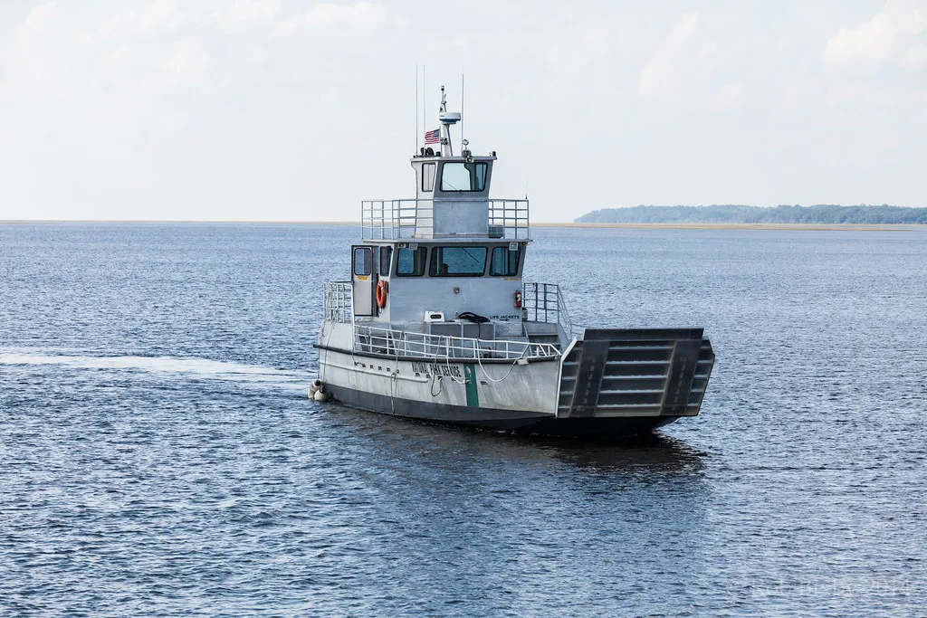
Part of what keeps Cumberland Island so intact is simply how difficult it is to overrun. There are no bridges, no roads connecting it to the mainland, and no cars allowed for day visitors. The island is only accessible by boat. The Cumberland Queen ferry runs three times a day from March 1 to September 30. Once ashore, visitors move entirely on foot or by bicycle along more than fifty miles of trails and roads. There are over 50 miles of trails and roads as well as 18 miles of beach. The National Park Service also caps how many people can be present at once. NPS restricts access to 300 people on the island at a time, and campers are allowed to stay no more than seven nights.
Managing Popularity While Protecting Wilderness
That low visitor ceiling has become a genuine point of discussion as interest in the island grows. In 2026, the National Park Service revived its Visitor Use Management Plan process to weigh whether and how access might expand. The NPS is back with VUMP in 2026 and your comments will make the difference again. One proposal under consideration would allow considerably more people onto the island each day than current limits permit.
Cumberland Island National Seashore offers visitors solitude and recreation in its 9,800 acres of designated wilderness and 17 miles of pristine beach, but these treasured offerings on Georgia’s largest barrier island are poised for change. Conservation groups have pushed back, arguing that even modest increases in foot traffic can accelerate erosion and disturb nesting wildlife, and the debate over where to draw that line is still unfolding as of this year.
Why Cumberland Island Matters for the Future of the Coast
What makes Cumberland Island worth understanding isn’t just its length of beach or its wild horses, though both are remarkable on their own. It’s the fact that an island this close to major population centers, this reachable, has stayed largely undeveloped through decades of pressure that flattened so much of the rest of the Atlantic coastline.
That outcome required real decisions made by real people, from Carnegie heirs who chose conservation over profit to federal legislators who backed a national seashore designation in 1972. Visiting responsibly, packing out every scrap of trash, staying on marked trails, and respecting the horses’ distance, is a small way for travelers to keep that legacy intact. Cumberland Island isn’t a place you check off a list; it’s a place that rewards patience, quiet observation, and a willingness to leave it exactly as you found it.
AI Disclaimer: This article was created with the assistance of AI tools and reviewed by a human editor.